mickoo
Western Thunderer
Not really sure where to put this, so here will do as I intend to populate this thread with a few photos taken on the 'Great Vacation' (GV)
It's only a few weeks away and I'm just tuning all the places I hope to visit. I've managed to wrangle a pass out for 17 of the 22 days and it'll cost me in brownie points for years to go I'm sure
So a basic itinerary follows. Land Orlando on Thursday evening, catch plane to Phoenix Friday morning which due to flying with the sun lands midday the same day, quick drive to Flagstaff for the first stop.

Because the area I wish to cover is so large I've had to break it down into four maybe five hotels/motels, an hours driving is an hour not taking photos!
Flagstaff sits at the highest point on Transcon 2 at the continental divide, Riordan being the actual summit a few miles west of Flagstaff. If there's going to be snow then it'll be here; the long range forecast gives it arriving around the 24th Apr. The green area is forested and quite rugged, not as rugged as say Donner Pass though, the rest is desert. The circle gives an idea of scale and that's how I've based my hotel choices. Sun up is roughly 06:00 with twilight 30 mins before and being as I want as many dawn and dusk shots as possible then it'll be out of the door by 04:30 or 05:00 latest depending on the drive distance.
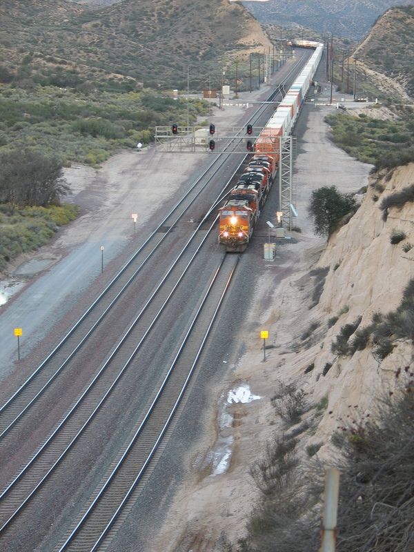
The map makes it look flat and with deserts in the mix you'd be mistaken for thinking the same, it's not, it's anything but flat, Riordan is just about 7300' ASL, yet Winslow to the East is a mere 5000' ish, a climb of 2300 feet in just over 50 miles. Up hill is a slog, but BNSF power there intermodals up to suit, so uphill speeds vary from 8-10 mph to 40-50 depending on the grade, down hill is 70mph.
The area in the circle is whats called the Seligman sub, the little star to the extreme left of the circle being Seligman, it's not helper country any more but some of the heavier trains still hold onto their DPU's until Winslow. Winslow is a crew change point so hopefully get some decent night roster shots from the Amtrak station.
The two Amtrak trains run mostly at night on this section to LA, unless running very late in which case you can bag them early morning if you're lucky.
For most of the route, in fact most of the whole trip, route 66 runs very close to the line so access is rarely more than 4-5 miles away and the 4x4 is booked to make the most of any dirt roads I need to use. Even though there's a lot of locations to visit it's not as daunting as it looks, with an average of three or four trains an hour it's easy to pick them off through out the day; the ones slugging up hill can be picked off at several locations with ease.
In total I've currently 4 nights in Flagstaff booked and then its a massive 380 mile drive to the West coast with a few photo stops around Bagdad, Cadiz and Siberia, all of which bear no resemblance to their real world locations.

Victorville is the longest stay at five nights but I may shuffle that to six and cut a day off on the way back somewhere else. Essentially I'm going to cover the Cajon pass, at least two days, possibly pick up West Colton and Beaumont hill (El Casco) way down south for one day. The only problem with Beaumont hill is the lack of trains, like Tehachapi it's about 20-25 a day, that for me is a very poor hit rate. Another day will be on Transcon 2 up from Cajon to Barstow and it's environs, hopefully some night shots of the yards.
Mind Barstow is the fifth most violent city in California with the roughest area being near the best spots for night shots, seems ok in daylight hours but night time runs the 1:12 risk of being a victim to crime. There are some other places that are safer, but the view less appealing; mind I have a cunning plan as most robber barons like to be tucked up in their fug pits around 05:00 An alternative is the holding areas to the West and East at Lenman or Dagget a few miles out of town.
Way up in the top right is Tehachapi and the Mojave desert, not sure how to play that as it can be a bit of a slow day on occasions but I should be able to pick up some good UP stuff, even if it's just held in sidings waiting for PW to finish. The trick with Tehachapi seems to be get there at sun up until mid morning, then go do something else until later in the afternoon. There's also some nice evening and night shots I want to do in the desert, Trona Pinnacles being one one of them, but I'm sure there are just as interesting rock formations to photography under the stars closer to base.
Cajon should be quite green as it's spring time, but it also means the rattlers are waking up and are most active, some rattler boots and a USFS explorer pass are required to do this area, the boots will come in handy later on as well.
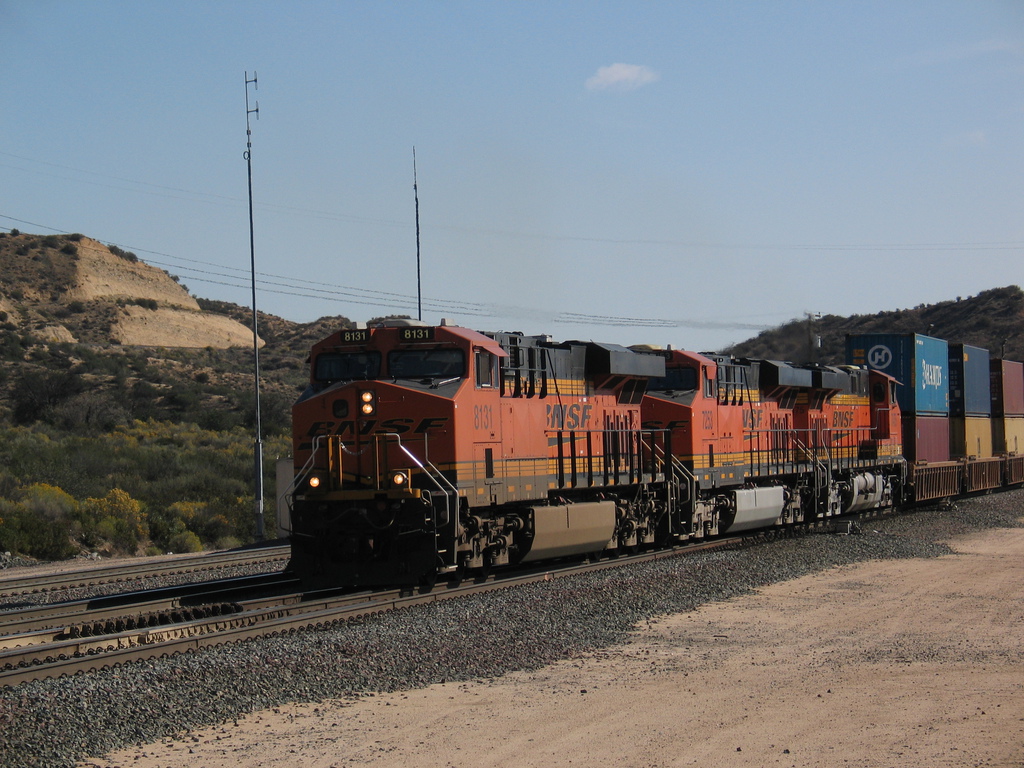
Cajon is helper area and they are cut off at Barstow or reduced on the bigger trains, BNSF is now running regular 12k (12,000' feet long) stackers which is a minimum 3x2x2 set up, especially if the weight is up near 8,000 tons.
Again like the Seligman sub, good roads parallel most of the line so access is very very easy, if you're a European. It does seem that our US cousins like to park on the ballast for their railfanning, walking a couple of miles to the line side seems to be rarely done, mind in high summer (Klondike and Siberia can be close to 45°C) I can fully understand but in Apr the hottest it'll get to in the desert is around 28-30°C
Moving on we're heading back East, didn't fancy a near 450 mile drive to catch the plane on the last day, even if it leaves at 22:30!
Now we back track to Needles first, even though the radius of operation is based as Kingman.

This is the lowest point on the Transcon 2 in this area, a mere 456' ASL and is a simple two night stop to allow me to head back West and pick up any spots missed around Bagdad and Klondike. Needles is also a crew change point so I'm hoping for some night shots as they change the crews at the Amtrak station. unlike other locations the staff at Needles seem less hostile to rail fans, so long as you behave nicely and be polite. Even so with the big lens on I'll still be able to bag some shots for a few hundred feet away.
Just south of Needles is the massive Topock bridge over the Colorado River and then the line begins to climb in earnest up toward Flagstaff, this is rugged desert country with plenty of photo sites to pick off. After a couple of days in Needles it's time to move on up to Kingman for three or four nights (I've a couple of days left at the end to either spend in Flagstaff, after Kingman or split back to Victorville and Knigman.
North of Kingman you're into really good photo country, Valentine, Hackberry and Crozier canyon being really good spots. Nelson tunnel is the only natural (not man made covering) tunnel on the whole Transcon but is intensely rare to photograph, surrounded by private mine land, BNSF ROW and Indian reservations. There's a couple of ways in and the nearest road is four miles away, so you can trek or use what ever tracks you can find and then use the BNSF ROW alongside the tracks, risky, illegal but often a blind eye turned....many locals use the ROW daily and for some it's their only access. I've a couple of routes that get me half way there and then trek but may decide on caution and take just go somewhere else mind the rewards and scenery are great if you can get there. Further east we come to Pica and just before that Yampai (star between Nelson and Pica).
Yampai is the top of the stiff climb from Kingman and equally steep climb from Seligman (far left star on the 70 mile boundary) Scenery here is stunning rolling hills and distant mountain ranges with S curves and the grade clearly visible on the stretched our 12K stacker, up hill engines are flat out and down to walking pace and visible easily ten miles away in the Audley valley.
After Seligman the line then climbs eastward toward the summit at Riordan and with two days spare I may opt to spend it here close to the main road back to Phoenix. In total it's over 450 route miles I'll cover if possible and at least 75 know photos spots listed, many only ½ mile apart.
Flight back to Orlando is 22:30 but flying against the sun lands at 05:30, too early to wake the family in the villa so a quick dash to Mulberry will be in order to pick up some CSX action and luck willing some final photos of the ACL signals at Lakeland, nearly all of the replacements are already in place so the old stalwarts have weeks if not days left, fingers crossed. With luck at that time of the morning I'll pick up the Winston locals going out on their rounds.
In the remaining few days I hope to pick up some local action between Disney, Malls and what ever honey do's I'm required to perform, basically 05:00-09:00 is my time
I'll stick some photos up here as and when the motel Wifi lets me.
Right, back to the maps and trails, there's a couple more locations around Needles I want to explore.
MD
It's only a few weeks away and I'm just tuning all the places I hope to visit. I've managed to wrangle a pass out for 17 of the 22 days and it'll cost me in brownie points for years to go I'm sure
So a basic itinerary follows. Land Orlando on Thursday evening, catch plane to Phoenix Friday morning which due to flying with the sun lands midday the same day, quick drive to Flagstaff for the first stop.
Because the area I wish to cover is so large I've had to break it down into four maybe five hotels/motels, an hours driving is an hour not taking photos!
Flagstaff sits at the highest point on Transcon 2 at the continental divide, Riordan being the actual summit a few miles west of Flagstaff. If there's going to be snow then it'll be here; the long range forecast gives it arriving around the 24th Apr. The green area is forested and quite rugged, not as rugged as say Donner Pass though, the rest is desert. The circle gives an idea of scale and that's how I've based my hotel choices. Sun up is roughly 06:00 with twilight 30 mins before and being as I want as many dawn and dusk shots as possible then it'll be out of the door by 04:30 or 05:00 latest depending on the drive distance.
The map makes it look flat and with deserts in the mix you'd be mistaken for thinking the same, it's not, it's anything but flat, Riordan is just about 7300' ASL, yet Winslow to the East is a mere 5000' ish, a climb of 2300 feet in just over 50 miles. Up hill is a slog, but BNSF power there intermodals up to suit, so uphill speeds vary from 8-10 mph to 40-50 depending on the grade, down hill is 70mph.
The area in the circle is whats called the Seligman sub, the little star to the extreme left of the circle being Seligman, it's not helper country any more but some of the heavier trains still hold onto their DPU's until Winslow. Winslow is a crew change point so hopefully get some decent night roster shots from the Amtrak station.
The two Amtrak trains run mostly at night on this section to LA, unless running very late in which case you can bag them early morning if you're lucky.
For most of the route, in fact most of the whole trip, route 66 runs very close to the line so access is rarely more than 4-5 miles away and the 4x4 is booked to make the most of any dirt roads I need to use. Even though there's a lot of locations to visit it's not as daunting as it looks, with an average of three or four trains an hour it's easy to pick them off through out the day; the ones slugging up hill can be picked off at several locations with ease.
In total I've currently 4 nights in Flagstaff booked and then its a massive 380 mile drive to the West coast with a few photo stops around Bagdad, Cadiz and Siberia, all of which bear no resemblance to their real world locations.
Victorville is the longest stay at five nights but I may shuffle that to six and cut a day off on the way back somewhere else. Essentially I'm going to cover the Cajon pass, at least two days, possibly pick up West Colton and Beaumont hill (El Casco) way down south for one day. The only problem with Beaumont hill is the lack of trains, like Tehachapi it's about 20-25 a day, that for me is a very poor hit rate. Another day will be on Transcon 2 up from Cajon to Barstow and it's environs, hopefully some night shots of the yards.
Mind Barstow is the fifth most violent city in California with the roughest area being near the best spots for night shots, seems ok in daylight hours but night time runs the 1:12 risk of being a victim to crime. There are some other places that are safer, but the view less appealing; mind I have a cunning plan as most robber barons like to be tucked up in their fug pits around 05:00
An alternative is the holding areas to the West and East at Lenman or Dagget a few miles out of town.Way up in the top right is Tehachapi and the Mojave desert, not sure how to play that as it can be a bit of a slow day on occasions but I should be able to pick up some good UP stuff, even if it's just held in sidings waiting for PW to finish. The trick with Tehachapi seems to be get there at sun up until mid morning, then go do something else until later in the afternoon. There's also some nice evening and night shots I want to do in the desert, Trona Pinnacles being one one of them, but I'm sure there are just as interesting rock formations to photography under the stars closer to base.
Cajon should be quite green as it's spring time, but it also means the rattlers are waking up and are most active, some rattler boots and a USFS explorer pass are required to do this area, the boots will come in handy later on as well.
Cajon is helper area and they are cut off at Barstow or reduced on the bigger trains, BNSF is now running regular 12k (12,000' feet long) stackers which is a minimum 3x2x2 set up, especially if the weight is up near 8,000 tons.
Again like the Seligman sub, good roads parallel most of the line so access is very very easy, if you're a European. It does seem that our US cousins like to park on the ballast for their railfanning, walking a couple of miles to the line side seems to be rarely done, mind in high summer (Klondike and Siberia can be close to 45°C) I can fully understand but in Apr the hottest it'll get to in the desert is around 28-30°C
Moving on we're heading back East, didn't fancy a near 450 mile drive to catch the plane on the last day, even if it leaves at 22:30!
Now we back track to Needles first, even though the radius of operation is based as Kingman.
This is the lowest point on the Transcon 2 in this area, a mere 456' ASL and is a simple two night stop to allow me to head back West and pick up any spots missed around Bagdad and Klondike. Needles is also a crew change point so I'm hoping for some night shots as they change the crews at the Amtrak station. unlike other locations the staff at Needles seem less hostile to rail fans, so long as you behave nicely and be polite. Even so with the big lens on I'll still be able to bag some shots for a few hundred feet away.
Just south of Needles is the massive Topock bridge over the Colorado River and then the line begins to climb in earnest up toward Flagstaff, this is rugged desert country with plenty of photo sites to pick off. After a couple of days in Needles it's time to move on up to Kingman for three or four nights (I've a couple of days left at the end to either spend in Flagstaff, after Kingman or split back to Victorville and Knigman.
North of Kingman you're into really good photo country, Valentine, Hackberry and Crozier canyon being really good spots. Nelson tunnel is the only natural (not man made covering) tunnel on the whole Transcon but is intensely rare to photograph, surrounded by private mine land, BNSF ROW and Indian reservations. There's a couple of ways in and the nearest road is four miles away, so you can trek or use what ever tracks you can find and then use the BNSF ROW alongside the tracks, risky, illegal but often a blind eye turned....many locals use the ROW daily and for some it's their only access. I've a couple of routes that get me half way there and then trek but may decide on caution and take just go somewhere else
mind the rewards and scenery are great if you can get there. Further east we come to Pica and just before that Yampai (star between Nelson and Pica).Yampai is the top of the stiff climb from Kingman and equally steep climb from Seligman (far left star on the 70 mile boundary) Scenery here is stunning rolling hills and distant mountain ranges with S curves and the grade clearly visible on the stretched our 12K stacker, up hill engines are flat out and down to walking pace and visible easily ten miles away in the Audley valley.
After Seligman the line then climbs eastward toward the summit at Riordan and with two days spare I may opt to spend it here close to the main road back to Phoenix. In total it's over 450 route miles I'll cover if possible and at least 75 know photos spots listed, many only ½ mile apart.
Flight back to Orlando is 22:30 but flying against the sun lands at 05:30, too early to wake the family in the villa so a quick dash to Mulberry will be in order to pick up some CSX action and luck willing some final photos of the ACL signals at Lakeland, nearly all of the replacements are already in place so the old stalwarts have weeks if not days left, fingers crossed. With luck at that time of the morning I'll pick up the Winston locals going out on their rounds.
In the remaining few days I hope to pick up some local action between Disney, Malls and what ever honey do's I'm required to perform, basically 05:00-09:00 is my time
I'll stick some photos up here as and when the motel Wifi lets me.
Right, back to the maps and trails, there's a couple more locations around Needles I want to explore.
MD
Last edited:
") and I'm working out how much I can sell the kids for to subsidise it
and I'm working out how much I can sell the kids for to subsidise it 

 .
. 
 .
.")
 . Who knows, maybe I'll sign up for a long weekend. I should check flights.