
You are using an out of date browser. It may not display this or other websites correctly.
You should upgrade or use an alternative browser.
You should upgrade or use an alternative browser.
Photo Ludgate Hill
- Thread starter 28ten
- Start date


28ten
Guv'nor
http://www.flickr.com/photos/9832585@N03/6378609681/Lovely photo, what is the source?
I have never seen the shot before, superb isnt it?


Buckjumper
Flying Squad
Like this:
http://maps.google.co.uk/maps?q=ludgate&hl=en&ll=51.514164,-0.102396&spn=0.002377,0.013937&sll=51.514171,-0.104445&sspn=0.002357,0.018024&t=h&layer=c&cbll=51.514167,-0.104445&panoid=naaNgEAqTun-5uJqWhqyNA&cbp=12,88.1,,0,-6.21&radius=0.47&hq=ludgate&z=17
Apparently the bridge was demolished in 1990 and the line routed sub-surface.
http://maps.google.co.uk/maps?q=ludgate&hl=en&ll=51.514164,-0.102396&spn=0.002377,0.013937&sll=51.514171,-0.104445&sspn=0.002357,0.018024&t=h&layer=c&cbll=51.514167,-0.104445&panoid=naaNgEAqTun-5uJqWhqyNA&cbp=12,88.1,,0,-6.21&radius=0.47&hq=ludgate&z=17
Apparently the bridge was demolished in 1990 and the line routed sub-surface.
Buckjumper
Flying Squad
And for those of us who marginally prefer our locomotives aspirated, c1900:


eastsidepilot
Western Thunderer
Marvelous Ade, fancy some perspective modellingAnd for those of us who marginally prefer our locomotion aspirated, c1900:

ATB, Col.
Buckjumper
Flying Squad
Aye. Couldn't fit a 1:43.5 model of St. Paul's in...

Neil
Western Thunderer
Thought I'd seen the photo before, it appears to have come from Diesel Heyday - Sulzer Diesels in the 1960s by Euslin Bruce. It should be possible to pick up a copy for a couple of quid or so. it's one of those books where the photos don't at first sight seem that special, but they do capture something of the time in a way that the better known photo albums don't always manage. If you like the Colour of a Lancashire Triangle then you'll probably like this one too.

Jordan
Mid-Western Thunderer
Cheers... must admit my Q was a shortcut way to find out without having to search for myself...Like this:
http://maps.google.co.uk/maps?q=ludgate&hl=en&ll=51.514164,-0.102396&spn=0.002377,0.013937&sll=51.514171,-0.104445&sspn=0.002357,0.018024&t=h&layer=c&cbll=51.514167,-0.104445&panoid=naaNgEAqTun-5uJqWhqyNA&cbp=12,88.1,,0,-6.21&radius=0.47&hq=ludgate&z=17
Apparently the bridge was demolished in 1990 and the line routed sub-surface.


Buckjumper
Flying Squad
Oi, cheeky!
Jordan
Mid-Western Thunderer


Yorkshire Dave
Western Thunderer
The bridge was pulled down when the new City Thameslink station was opened shortly after Holborn Viaduct was closed. From Blackfriars the line dives down a 1 in 30 gradient on a new alignment to City Thameslink and onto the widened lines at Farringdon. City Thameslink station occupies the site between Ludgate Hill and Holborn Viaduct and is accessed from these two streets It accommodates 12 car trains and are least two carriage sidings as well. Not having worked in London for at least 12 years now, I could not say whether the station is being improved as part of the Thameslink upgrade.

mickoo
Western Thunderer
Some more shots of interest, authors unknown but off the web, mostly many years ago.

View looking south toward the bridge and Ludgate hill station (EMU). To the right, the original descent to Snow Hill and Farringdon.

View north from Blackfriars showing Ludgate Hill station, end of train would be on the bridge.

Another view looking south showing the bridge and Ludgate Hill station

Another view looking north showing the bridge, almost the exact same location as the class 24. Also shows the original descent to Snow Hill and Farringdon.
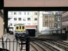
View today from Blackfriars showing new descent further south, Ludgate Hill station would have been just above that red brick parapet.
Regards
View looking south toward the bridge and Ludgate hill station (EMU). To the right, the original descent to Snow Hill and Farringdon.
View north from Blackfriars showing Ludgate Hill station, end of train would be on the bridge.
Another view looking south showing the bridge and Ludgate Hill station
Another view looking north showing the bridge, almost the exact same location as the class 24. Also shows the original descent to Snow Hill and Farringdon.
View today from Blackfriars showing new descent further south, Ludgate Hill station would have been just above that red brick parapet.
Regards